6 Days from$1960 p/p in USD
- DeparturesYear Round

Destinations
Tanzania,
Tour Type
Guided
Safari Standard
Mid Range
Tour Overview
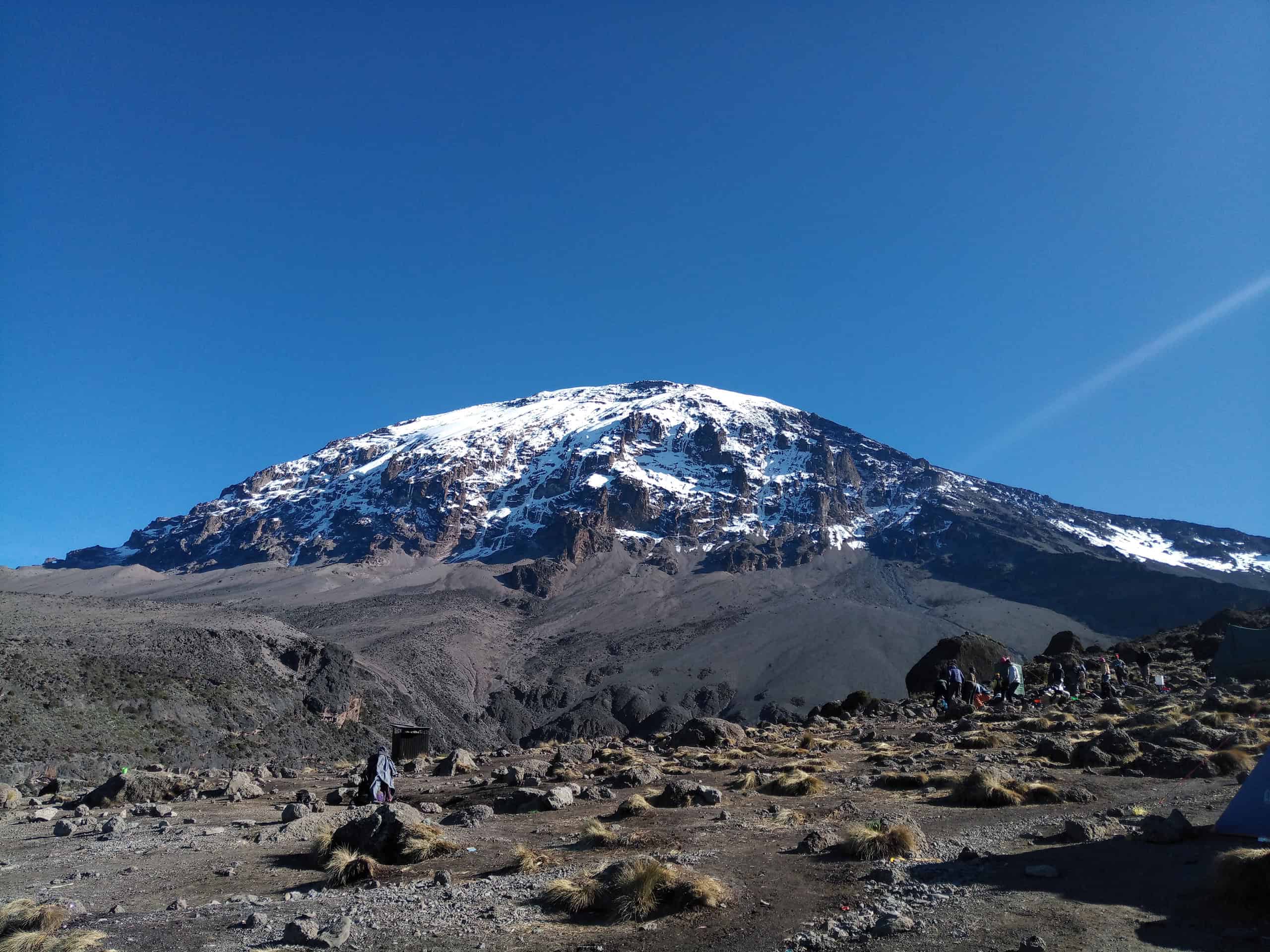
The Machame Route, also referred to as the ‘whiskey route’, is one of the most popular routes on Kilimanjaro and a favorite for us. Machame route is one of the highest summit success rates given the topography and nature of the route which allows climbers to “trek high & sleep low” hence making it a more favorable route for acclimatization. This route offers some of the most spectacular scenery while on the mountain. The Machame route starts in the southwest side of the mountain and proceeds steeply north, traversing the Shira plateau and eventually joining the Shira and Lemosho routes just after the Shira Cave Camp. The Machame route can be done in minimum 6 days but a 7-day trek is recommended to allow climbers been well rested and acclimatized before making the final ascent to the summit.
General Information
- Safari types:Guided Safari, Mountain Safari, Trekking Safari
- Activities:Trekking
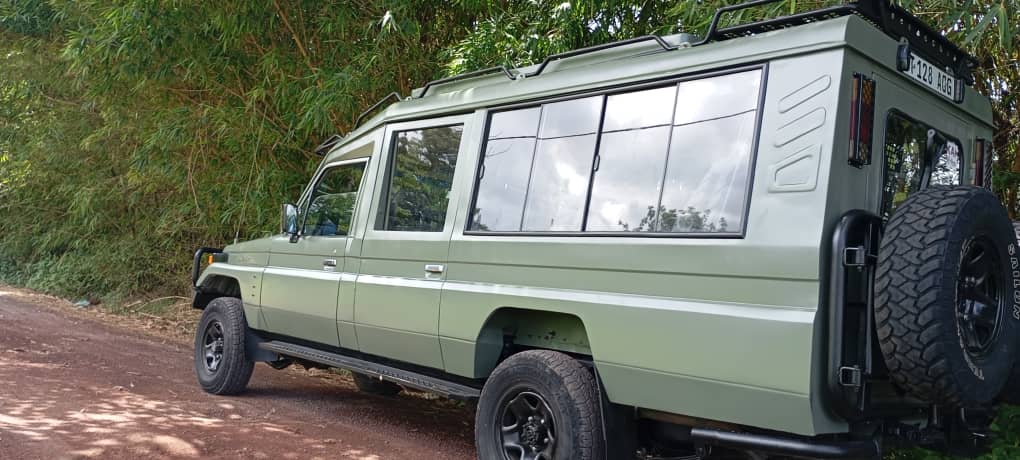
- Getting around:Transfer Vehicle
- Start/end:Start in Moshi-Kilimanjaro, end in Moshi-Kilimanjaro
- Minimum age:7 years
Price Per Person – USD
From USD 1,960 per person
What's Included
- 2 nights hotel stay before and after trek in Moshi
- Private return transport to and from Kilimanjaro Airport & your accommodations in Moshi
- Transportation to & from the Kilimanjaro gate
- 4 season mountain tents with comfortable sleeping mattress
- Friendly, professional mountain guides, cook and porters [average ratio of support staff to climber is 4:1 in a group]
- 3 hot meals daily & treated/filtered drinking water throughout the trek
- Hot water for washing
- Fair wages for the mountain crew as approved by the Kilimanjaro National Park Authority (KINAPA), Kilimanjaro Association of Tour Operators (KIATO)
- Portable oxygen tanks & ox meter, emergency first-aid kit
- National Park entry fees, camping fees, rescue fees
- 18% VAT on tour fees & services
- Government taxes
What's Excluded
- Flights & visas
- Lunches, dinners & drinks at your hotel before and after climb
- Portable flush toilet with a toilet tent available for rent $100 for the entire trip to be shared in a group
- Laundry (available at hotel)
- Tips for guides, porters and cook – this is a guide to tipping on the mountain Kilimanjaro:
• Guides: $20/day/guide
• Cook: $15/day
• Porter: $10/day/porter
Disclaimer
- This itinerary is owned and delivered by ‘Kilisa Tours & Safaris‘
- All prices are ‘From’ and may vary at the time of booking
- Display price is usually based on two people sharing
- ‘Kilisa Tours & Safaris‘ reserves the right to change the content and price of the itinerary
- All itineraries and services are subject to availability
Day by Day Overview
ll trekkers need to organize their own flight to Kilimanjaro international Airport [JRO]. From JRO you will be met by our staff and transferred to Moshi in the peaceful surrounds of our comfortable pre and post trek accommodation from where there are great views of the mountain. You can relax by the pool before your briefing with the guides, who will provide the essential information for your trek to the roof of Africa.
- Overnight: Parkview Inn Hotel

The drive from Moshi to Mount Kilimanjaro National Park Gate takes about 50 minutes. The journey passes through the village of Machame, which is located on the lower slopes of the mountain. After finishing registration, we leave the park gate and walk through the rainforest on a winding trail up a ridge. Lower down, the trail can be muddy and slippery. Gaiters and trekking poles are a good idea here. We continue a short distance until we reach the Machame Camp for overnight.
- Elevation (ft): 5,400ft to 9,400ft
- Distance: 11 km
- Hiking Time: 6-7 hours
- Habitat: Rain Forest
- Transport: Private
- Accommodation: Camping
- Meals: Breakfast/ Lunch / Dinner

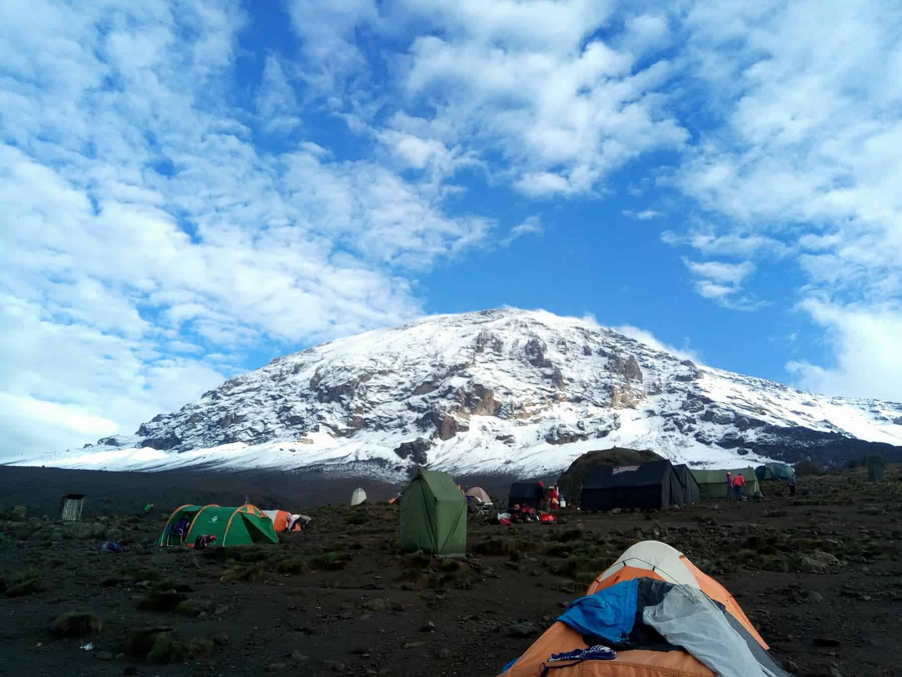
After breakfast, we leave the glades of the rainforest and continue on an ascending path, crossing the little valley, walking along a steep rocky ridge, covered with heather, until the ridge ends. The route now turns west onto a river gorge. Time for rest, dinner, and overnight at the Shira campsite. It will be colder tonight than the previous night with temperatures possibly falling below freezing.
- Elevation (ft): 9,400ft to 12,500ft
- Distance: 5 km
- Hiking Time: 5-6 hours
- Habitat: Moorlan
- Accommodation: Camping
- Meals: Breakfast/ Lunch / Dinner

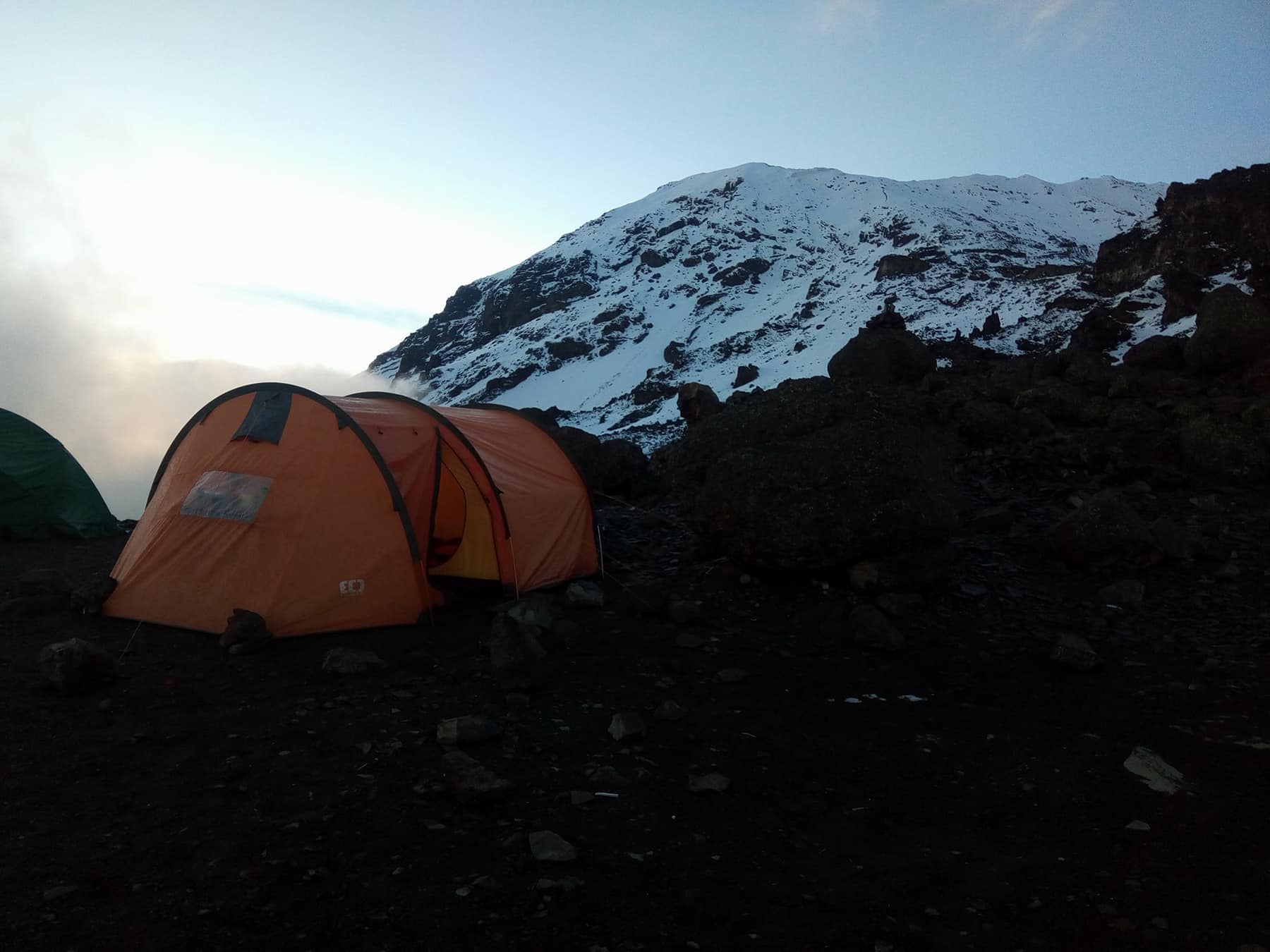
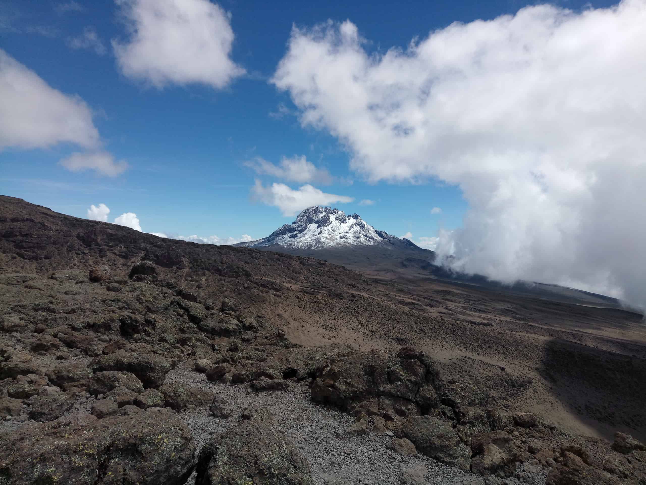
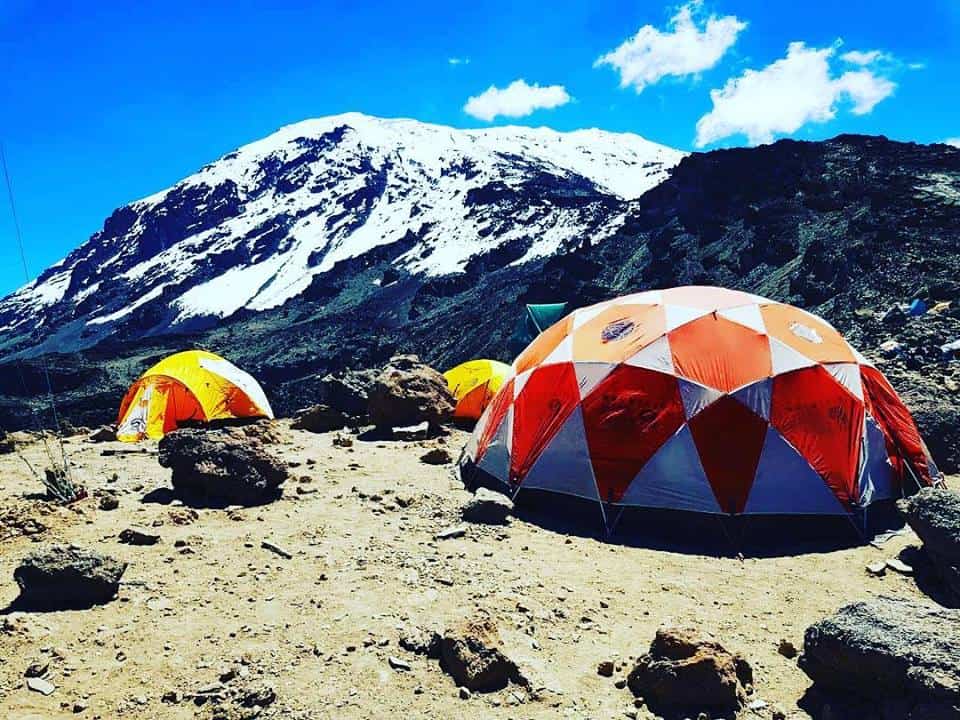
From the Shira Plateau, we continue to the east up a ridge, passing the junction towards the peak of Kibo. As we continue, our direction changes to the southeast towards the Lava Tower, called the “Shark’s Tooth.” Shortly after the tower, we come to the second junction which brings us up to the Arrow Glacier at an altitude of 16,000ft. We now continue down to the Barranco Hut at an altitude of 13,000ft. Here we rest, enjoy dinner, and overnight. Although you end the day at the same elevation as when you started, this day is very important for acclimatization and will help your body prepare for summit day.
- Elevation (ft): 12,500ft to 13,000ft
- Distance: 10 km
- Hiking Time: 6-8 hours
- Habitat: Semi Desert
- Accommodation: Camping
- Meals: Breakfast/ Lunch / Dinner

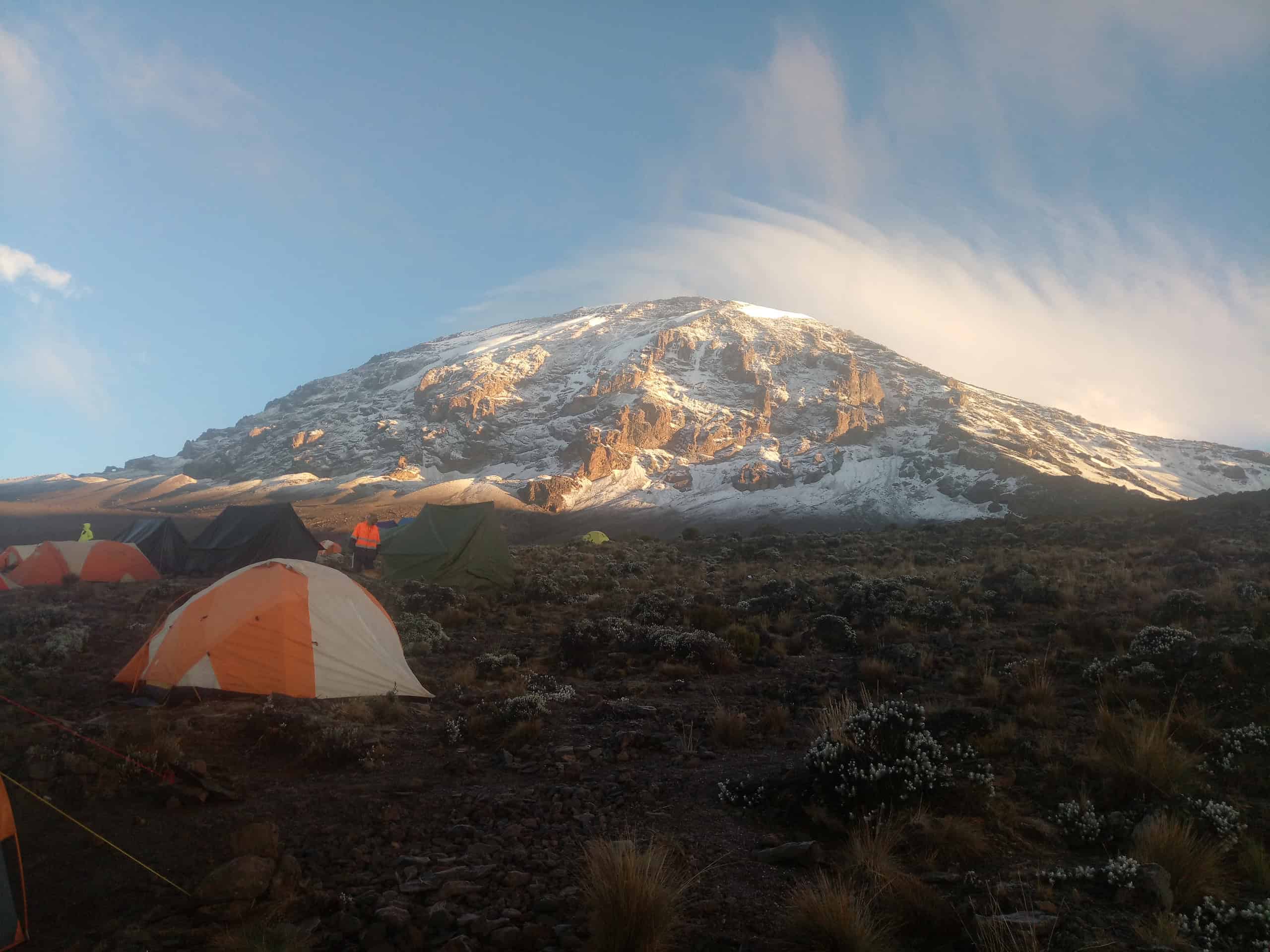
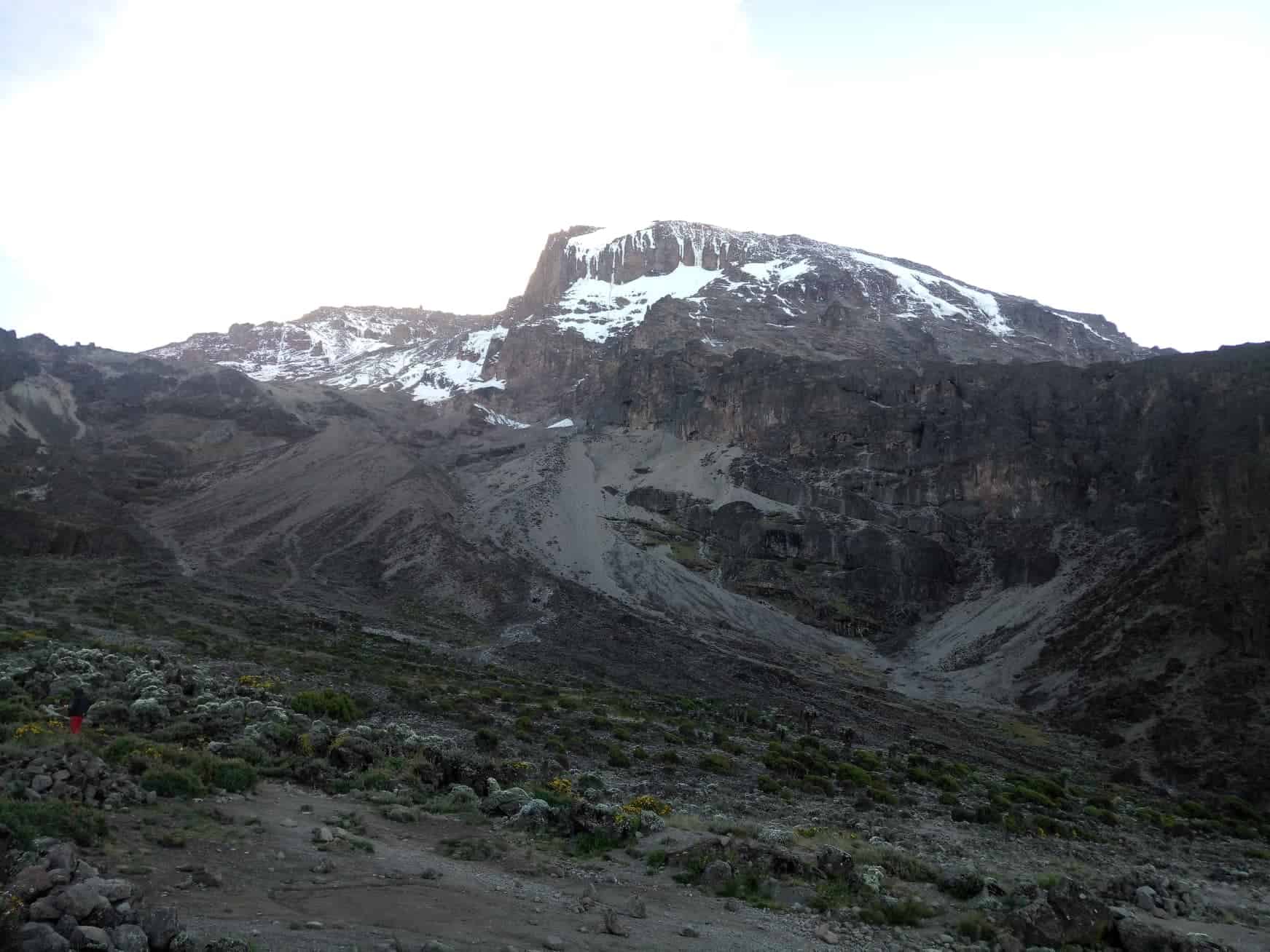
After spending a night at the Great Barranco Wall (a very imposing sight at first), you make your way up this awesome looking obstacle, which in the end normally turns out easier than what you anticipated. Topping out just below the Heim Glacier, you now appreciate just how beautiful Kilimanjaro really is. The route then heads down through the Karanga Valley over intervening ridges and valleys, and then joins up with the Mweka route. This is the preferred route down from the summit, so remember it. Turn left up the ridge and after another hour or so, you reach Barafu Hut.
The last water stop on the route is the Karranga Valley, as there is no water at Barafu camp. Barafu is the Swahili word for “ice” and it is a bleak and inhospitable camping area to spend the night. Totally exposed to the ever-present gales the tents are pitched on a narrow, stony, and dangerous ridge. Make sure that you familiarise yourself with the terrain before dark to avoid any accidents. The summit is now a further 1345m up and you will make the final ascent the same night. Prepare your equipment, ski stick and thermal clothing for your summit attempt. This should include the replacement of your headlamp and camera batteries and make sure you have a spare set available as well. To prevent freezing it will be wise to carry your water in a thermal flask. Go to bed at round about 19h00 and try to get some precious rest and sleep.
- Hiking time: 7h
- Distance: Approximately 13 kms
- Habitat: Alpine desert
- Accommodation: Camping
- Meals: Breakfast/ Lunch / Dinner

You will rise around 23h30, and after some tea and biscuits you shuffle off into the night. You will head in a north-westerly direction and ascend through heavy scree towards Stella Point on the crater rim. For many climbers, this 6-hour walk to Stella point is mentally and physically the most challenging on the route. At Stella Point (5685m) you will stop for a short rest and will be rewarded with the most magnificent sunrise you are ever likely to see (weather permitting). From Stella Point you will normally encounter snow all the way on your 2-hour ascent to Uhuru Peak. The time you will spend on the summit will depend on the weather conditions. Do not stop here for too long, as it will be extremely difficult to start again due to cold and fatigue. Enjoy your accomplishment and a day to remember for the rest of your live.
The walk back to Barafu from the summit, takes about 3 hours. Here you will have a well-earned but short rest and collect the rest of your gear. The route is not difficult and will take you down the rock and scree path into the moorland and eventually into the forest. The camp is situated in the upper forest and mist, or rain can be expected in the late afternoon. Dinner and washing water will be prepared.
- Hiking time: 8h to reach Uhuru Peak, 7 – 8h to descend to Mweka.
- Distance: Approximately 7 kms ascent – 23 kms descent
- Habitat: Stone scree and ice-capped summit
- Accommodation: Camping
- Meals: Breakfast/ Lunch/ Dinner


Login to your account


Register as a traveller if you are looking for deals
Register as a travel partner if you offer amazing safaris